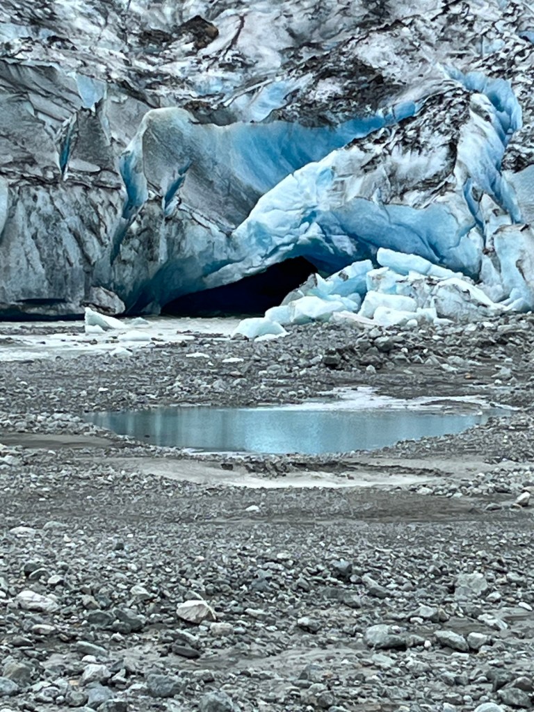
We are now no longer in Alaska, but we had some experiences there that we haven’t recorded yet. Lest we forget, it’s time to remember the last part of the Alaskan journey, and get it written down. Our time in Glacier Bay was over, and it was time to make a decision: Shall we go back the way we came, stopping at favorite spots, and some new spots, or shall we take an entirely different route on our way South? Which choice do you think won out? That’s right… we opted for a new experience. Upon emerging from Glacier Bay, we decided to turn right instead of left. As we proceeded into Icy Strait, there was strong current running. Mike was hand steering the boat through the tide rips and whirlpools, and doing a fine job. A large humpback swam right across our track, not far from the bow. Always on the lookout for wildlife, we took this as confirmation that we had made the right choice.
As I have mentioned, the current was running strong in the strait, and it was also strong among these small islands which lie just on the edge of the Pacific Ocean. The current was giving us quite a speed boost as we nosed through the Inian Islands. Suddenly, we were in Wild Kingdom! On our right, we saw teeming, tumbling masses of sea lions, swimming and hunting, while on the shore other sea lions roared and growled. At the same time, on our left side, a pod of humpbacks was blowing, squealing, swimming and feeding. Following the whales were porpoises, catching the leftovers from the whales. The porpoises were followed by more sea lions. Flying above them all were the seagulls and a few puffins, also looking for an easy lunch. There was a whole food chain happening right in front of us! We could only imagine what was going on below the surface. It was thrilling!
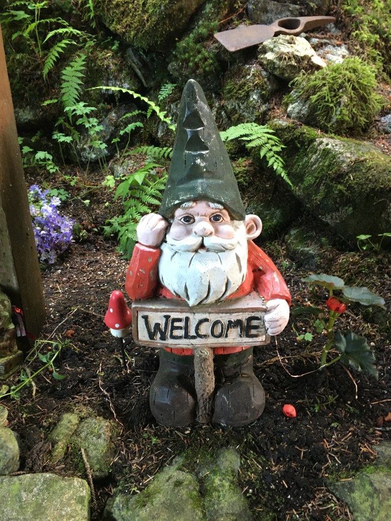
The current pushed us out of the islands and we made our way to the quiet little town of Elfin Cove. The place is aptly named, because it is enchanting. It isn’t really town-like, but more of a long, circular trail bordering a cove. Part of the trail is through the forest, and part is boardwalk, which leads past houses and a few small businesses. Tucked here and there along the trail, and in people’s yards, are all kinds of elves. Some are large, some are tiny, some are slightly risqué. It is a surprise to come upon them while walking the path around the cove. There are fishing boats in the cove, as this is a big area for both sport fishing and commercial fishing. The store was small, and didn’t have much that we needed, but it was fun to be greeted by the friendly store dog.

Back on Voyager, we continued down the coast, while salmon were jumping like crazy all around the boat. The pinks were running, and they characteristically jump out of the water while on their migration to spawn. Some sources say that they jump to rid themselves of sea lice that attach themselves to the fish. Others say it’s to escape predators. But what it looks like is a competition to see who can jump the highest. Some jump 6 feet straight up, some go sideways 5 or 6 times like a skipping stone, some keep jumping until they obviously just can’t do one more jump. We told them that they were welcome to jump on our boat, but somehow, they managed to miss us.
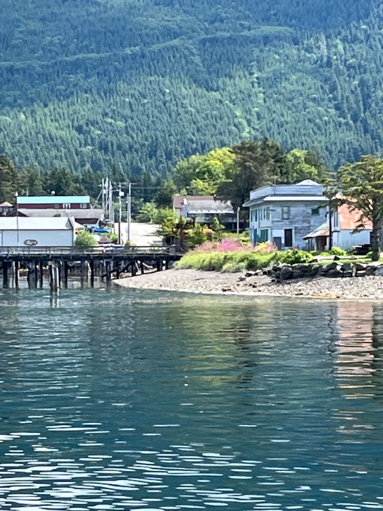
Arriving in Pelican, we felt like we were truly in an old Alaskan village. Again, there were both commercial and sport fishing boats on the docks. In the evenings, the chartered fishing boats would return from their day, and unload the fish into wheelbarrows. They would end up outside the hotel where they would line up all the fish on the boardwalk outside the hotel. These men from all over the United States, who had flown in for an extended fishing trip, were standing with puffed out chests like proud schoolboys, as the pictures were taken of each man’s catch. They stood around telling stories about the day, and the big one that got away, and the shark that tried to steal the fish… That was one facet of Pelican. Then there was the fish processing plant, where the commercial boats would unload their holds full of fish, fill up with fuel, and turn around to go fish again. The hardworking fishermen don’t waste a minute of the season, and I have nothing but admiration for the way they go out in all weather conditions to work while they can.
The town of Pelican consists mainly of one wide boardwalk about half a mile long. There is a grocery store with food staples, a post office, harbormaster’s office, a fuel station, a breakfast/lunch coffee shop, a bar/pizza parlor for dinners, a small library, and way down at the end of the dock, a K-12 school. Last year the school had 8 students. The few year-round residents are hearty, salt of the earth, hardworking people. Without exception, everyone we met there said hello, looked you in the eye, and were open to friendly conversation, unless they were on a 4-wheeler, whizzing up or down the boardwalk. Then you’d better just get out of the way! We enjoyed our glimpse of Alaskan life, and realized that we have it pretty easy at home in Murphys.
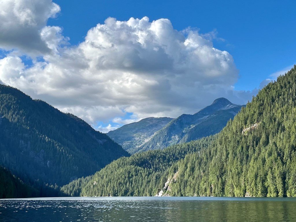
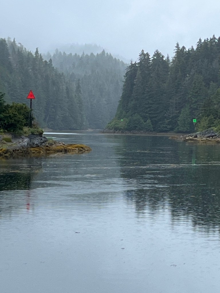
Heading north once more to round Chichagof Island and make our way down the east side, we studied the guidebook as we contemplated making the passage through Rocky Pass to get to our route. The book described Rocky Pass as a shallow, rocky passage, marked by buoys to guide boats through a winding route, containing a section of dredged, narrow channel to go through. Then we heard from other boaters that some of the buoys were missing, or misplaced! In addition, the Coast Guard does not recommend this passage, and has made a statement that they won’t come rescue you if you run aground there. Basically, if you’re brave or foolhardy enough to go that way, you’re on your own! I was a bit nervous about this. But Mike was confident that with our charts and our depth finder, we’d be able to navigate the challenging passage. That man does love a challenge!
Our plan was to go through the passage, then cruise around the West side of Prince of Wales Island. We would be able to take inland passages most of the way, but there would be some “outside” time in the ocean, and we would end up with a longer big-ocean passage at the end, when we made the run from the tip of the island to Prince Rupert, where we would enter Canada. I was trusting that we would have some good weather for that crossing (another challenge).
As we approached Rocky Pass, we found the first buoy, and up ahead we spotted the second one: Red buoys on the left, green buoys on the right. Taking a big gulp, off we went. We did find that some buoys were missing from their broken-down platforms. We did find that the dredged passage was narrow and shallow. We did see rocks sticking out everywhere just to the sides of our “path.” But in the end, we did just fine, taking it slow, checking our charts, watching the depth finder, and me on deck keeping a bow watch at times. We made it! Then we looked at each other and said, “I’ve seen worse…” I guess that’s what a little experience will do for you.
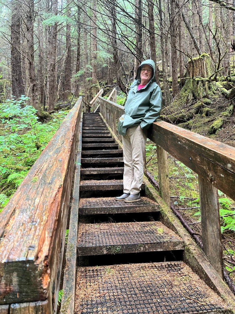
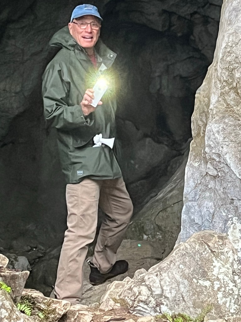
We entered El Capitan passage on a rainy day, with clouds obscuring the scenery. It is named El Capitan because of its similarity to Yosemite, and the big cliffs there. We were sorry to not see any of it, but we did stop and hike 370 stairsteps up to the entrance to El Capitan Cave. This cave is the deepest cave in Alaska, and we had never heard of it. Tours are given by arrangement, but not on the day we were there, so we just poked our heads inside.
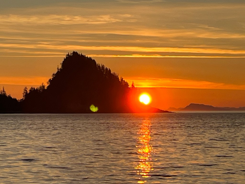
Eventually, we rounded the tip Prince of Wales Island. The next morning was calm, and so we left as the sun rose, at 4:30 in the morning, waking a sleeping humpback whale as we left the cove. Our crossing was safe and uneventful. As we checked in to Prince Rupert, Canada, we began to get the feeling that it was time to go home!
-beth